Paynesville - Dinni Birraark Walk
The improvement of the current condition of the Dinni Birraark Walk in Paynesville was identified by the Paynesville Landcare Coastcare group and adopted in the Paynesville Foreshore Management Plan.
Council is working with the Paynesville Landcare Coastcare Group to improve the walking trail over an approximate length of 400m from Sunset Cove westwards towards Jones Road, as part of the Dinni Birraark Walk. The area has been surveyed and is currently being investigated and assessed.
The aerial image shows the approximate trail location; the exact location will be determined during the detailed designed.
Objective and Scope
The objective of this project is to continue development towards a linking pathway between Paynesville and Newlands Arm as highlighted in the Paynesville Foreshore Management Plan.
- Improvement of approximately 400m of existing trail.
- Erosion mitigation where required.
Consultation and Community Engagement
Council is pleased to be supporting this community driven project, identified by the Paynesville Landcare Coastcare Group.
Funding
Funding for this project is provided by East Gippsland Shire Council in the adopted 2023/2024 budget and is allocated to works pertaining to the improvement of an approximate 400m of the existing pathway.
Further works to create a linking pathway between Paynesville and Newlands Arm, as highlighted in the Paynesville Foreshore Management Plan, is subject to the success of future funding applications.
![]()
We welcome your continued interest in this project; project updates will be provided on YourSay in the tab below, when available. Please click on 'Subscribe' at the top of the page to follow this project and to receive important information directly to your inbox.
Should you wish to search for other projects near you, simply type the town name in the search bar.
-
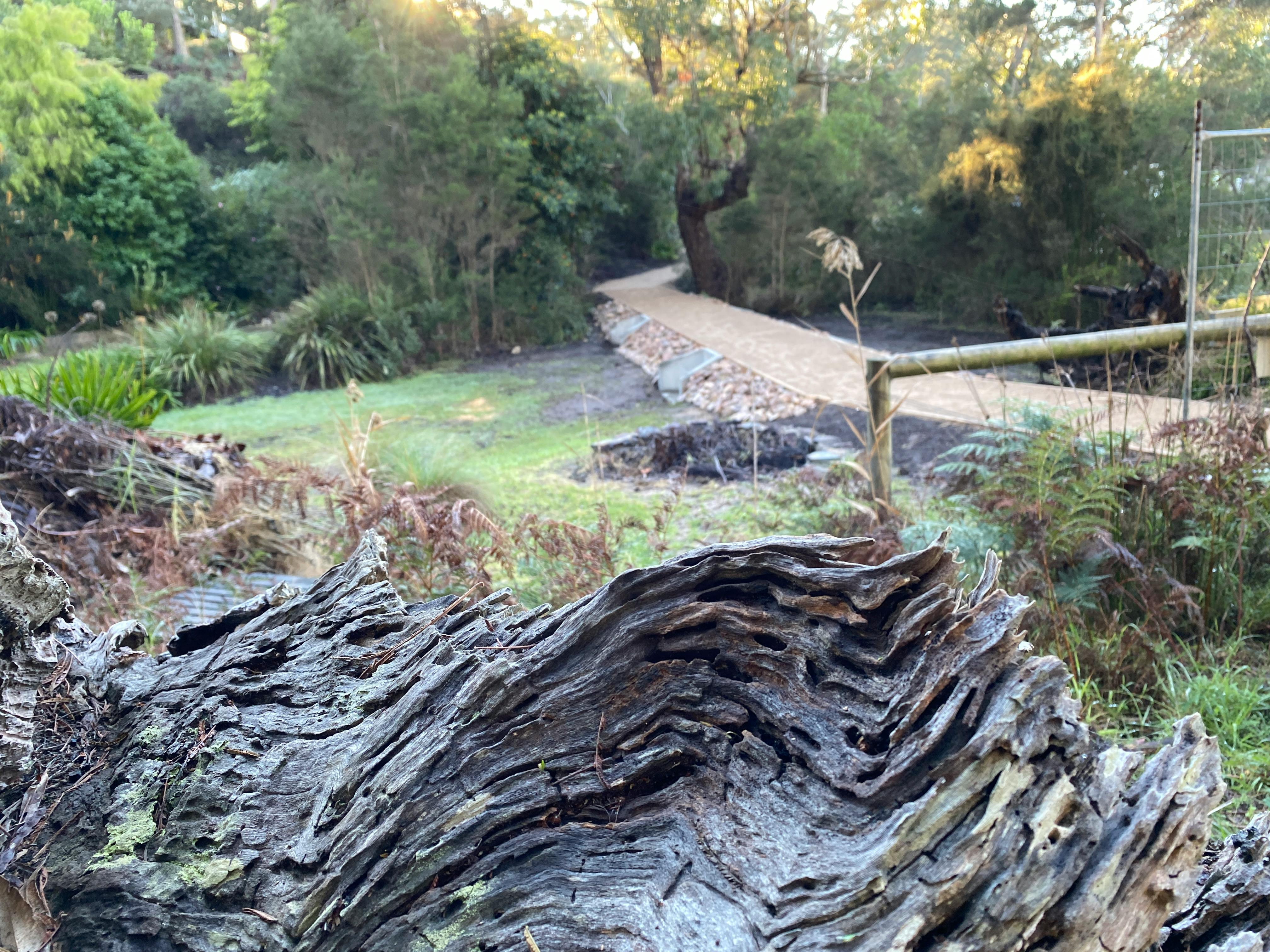
Dinni Birraark Walk Now Open!!
Share Dinni Birraark Walk Now Open!! on Facebook Share Dinni Birraark Walk Now Open!! on X (formerly Twitter) Share Dinni Birraark Walk Now Open!! on Linkedin Email Dinni Birraark Walk Now Open!! link
Council is pleased to announce that the Dinni Birrarrk Walk project has now been completed and is open for the community and visitors to enjoy.
This project has been a fantastic collaborative effort. Council would like to thank Cal Civil for their hard work, professionalism and commitment throughout construction. Their quality workmanship has helped deliver a wonderful outcome for Paynesville.
Council would also like to acknowledge Paynesville Landcare for their ongoing support and involvement throughout the project. Their contribution has played an important role in helping bring this project to life.
A final thank you also goes to residents, trail users and visitors for your patience and understanding while works were underway. We know construction activities can cause temporary inconvenience, and we greatly appreciate the support shown by the community throughout the project.
The completed walk is a wonderful asset for the area, improving access while allowing locals and visitors to experience the natural beauty of the Paynesville foreshore. Council looks forward to seeing the trail enjoyed for many years to come.
Click 👉 here to view photos of the completed Dinni Birraark Walk
-
Entering the Final Stages 🎉
Share Entering the Final Stages 🎉 on Facebook Share Entering the Final Stages 🎉 on X (formerly Twitter) Share Entering the Final Stages 🎉 on Linkedin Email Entering the Final Stages 🎉 link
The Dinni Birraark Walking Trail Extension is now entering its final stages, with only approximately 80 metres of trail remaining to be completed. Cal Civil has made good progress throughout the project, and we are pleased to see the works nearing completion.
We would like to thank everyone for their patience and understanding during the construction period. The temporary disruptions will soon be behind us, and the completed trail will enhance access to and enjoyment of this valued natural area for both the community and visitors alike.
Over the coming weeks, final works will be completed, and the trail will be ready to reopen for public use. We look forward to sharing the finished project with the community and appreciate the ongoing support shown throughout the delivery of these important improvements.
Click 👉 here to see additional photos of the works that are nearing completion
-
June 2026 update
Share June 2026 update on Facebook Share June 2026 update on X (formerly Twitter) Share June 2026 update on Linkedin Email June 2026 update link
Construction of the Dinni Birraark Trail is progressing smoothly, with contractor Cal Civil making solid progress across the site.
Most of the rock beaching has now been installed, and the trail is clearly starting to take shape, helping define the final alignment of the trail.
Upcoming works will focus on raising sections of the trail and constructing retaining walls near the Kellina Court end, before progressing toward completion of the trail through to the Backwater Court end.
We would like to thank the community for their patience while these works are underway.
Click 👉 here to see photos of some of the works that have been completed
-
📅 July 2025
Share 📅 July 2025 on Facebook Share 📅 July 2025 on X (formerly Twitter) Share 📅 July 2025 on Linkedin Email 📅 July 2025 linkWe are working to improve a 400m section of the Dinni Birraark Walk, from Sunset Cove westward toward Jones Road. The area has been surveyed and is currently being assessed to inform the detailed design.
Our project supervisor is currently following up on materials and the works schedule. We look forward to sharing further updates soon.

-
1 May 2024
Share 1 May 2024 on Facebook Share 1 May 2024 on X (formerly Twitter) Share 1 May 2024 on Linkedin Email 1 May 2024 linkA survey of the project area was recently completed. Council officers are now reviewing the survey results to understand the existing conditions which will inform the future pathway works.
The ecological assessments, Cultural Heritage Assessment, and engagement with Gunaikurnai Land and Waters Aboriginal Corporation (GLaWAC) are currently being undertaken.