
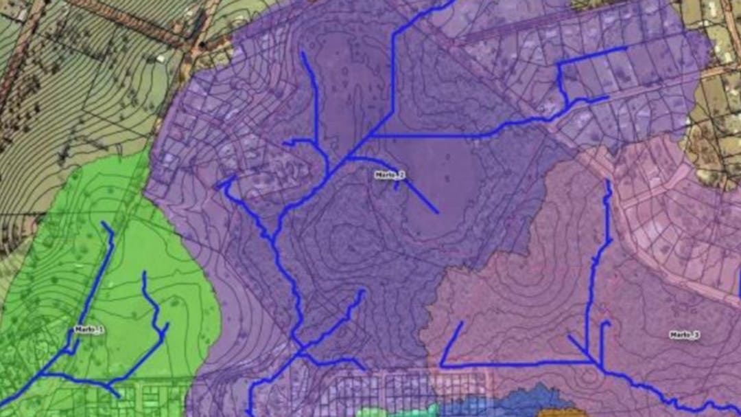
Marlo - Town Drainage
We are working to address flooding issues in Marlo, following concerns raised by the community. Funding has been secured to begin site investigations and flood modelling, with consultants engaged to lead this work.
The project includes:
- Hydrological and hydraulic modelling to understand how water moves through the township and assess the performance of existing drainage infrastructure.
- Water quality modelling to ensure stormwater runoff meets best practice treatment standards.
- Feature survey completed in September 2022 to fill gaps in drainage network data.
- Site inspection and desktop review conducted in August 2022 to identify flood-prone areas and review future development plans.
- Flood modelling and feasibility assessments to explore mitigation options.
- Detailed engineering design of new stormwater infrastructure.
- Construction and commissioning of upgrades by a civil contractor.
Project Objectives
- Understand flood behaviour in Marlo.
- Test and improve existing drainage systems to protect private properties and support future development.
- Ensure stormwater runoff is managed to meet water quality standards.
Funding
Current funding covers flood mitigation works at the caravan park hotspot only. Council is actively seeking additional funding to address other flood-prone areas in Marlo.
This project is in addition to the Marlo Foreshore Management Plan Implementation (click on the link to read more)
For more information regarding project updates please subscribe or contact Council Officers at feedback@egipps.vic.gov.au
Should you wish to search for other projects in your town, simply type the town name in the search bar.
Questions and/or Feedback
Your questions and/or feedback are welcome on this project - your input is valuable, and we are pleased you are on this journey with us.
The project supervisor will be advised of your response and will look closely at what you have said - all feedback is important and will be considered.
The project supervisor's response can be posted publicly or privately - please let us know if you would prefer to be answered privately.
Who's Listening
-
Phone 0351539500 Email feedback@egipps.vic.gov.au